| Annual program and technical progress report |
-
Activity Report 2023
-

Technical Program 2024
|
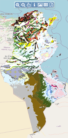
| Geocatalogue |
|
| Invitation to
tender |
-

REALIZATION OF THE TRAINING PLAN FOR THE YEAR 2022
-

ACQUISITION OF TWO SERVICE CARS
-
ACQUISITION OF GEORADAR EQUIPMENT AND ITS ACCESSORIES
|
|
Invest in Tunisia |

|
|
|
|
|
::
Documentation and Editions
>>
Research library
|
| |
|
[
Search by author
]
[
Search keyword
]
[
Search by index
]
[
Search by category
]
|
title of the reference :
|
Gravity constraints on the structure of the northern margin of Tunisia
|
|
Publication Date:
|
2002
|
|
Author :
|
Jallouli Chokri, Mickus K., Turki Mohamed Moncef
|
|
Catalogue type :
|
Livre
|
|
Catalogue reference :
|
N°151 Geophys. J. Int. N°151 Gravity constraints on the structure of the northern margin of Tunisia Implications on the nature of the northern African Plate boundary. Bouguer gravity data were analysed to determine the general crustal and upper-mantle structure in northern Tunisia. Residual gravity anomalies were determined by removing the gravitational effect of crustal thickness variations imaged by regional seismic experiments. Residual gravity anomalies contain short-wavelength anomalies superimposed on a long-wavelength component that decreases in amplitude northward towards the Tunisain coastline. An edge-enhancement analysis of the short-wavelength anomalies suggests a previously unknown east-west-trending gravity anomaly south of 37°N with source depths of between 3 and 7 Km. Modelling of residual and Bouguer gravity anomalies indicate that there are two possible solutions for the residual gravity decrease in northern Tunisia : (1) thickening of Cenezoic and Mesozoic sediments north of a strike-slip fault or (2) a crustal and upper-mantle low-density zone interpreted as being crustal material of the remnant subducted African Plate. The latter resultat is favoured based on seismic tomographic images of the Mediterranean region, which implies that subducting material exists under the African coast, geological inter-pretations suggesting that the Tell Atlas may be a thurst wedge accreted by underplating of the Africain continental crust and seismic refraction models, indicating a thinning of sediments in nothern Tunisia. The east-west trending gravity anomalies south on 37°N correspond to an important structural feature that may be related to either a structural boundary or subduction beneath the Africain Plate.
référ. bibliogr. gravimétrie ; anomalie gravimétrique ; Cénozoique ; Mésozoïque ; sismicité ; Tunisie ; Tunisie nord Occidentale ; Tunisie Nord Orientale Mickus K. Turki Mohamed Moncef Jallouli Chokri Géophysique Appliquée
|
|
Indexation decimale :
|
Géophysique Appliquée
|
|
Keywords :
|
gravimétrie ; anomalie gravimétrique ; Cénozoique ; Mésozoïque ; sismicité ; Tunisie ; Tunisie nord Occidentale ; Tunisie Nord Orientale
|
|
Summary :
|
Bouguer gravity data were analysed to determine the general crustal and upper-mantle structure in northern Tunisia. Residual gravity anomalies were determined by removing the gravitational effect of crustal thickness variations imaged by regional seismic experiments. Residual gravity anomalies contain short-wavelength anomalies superimposed on a long-wavelength component that decreases in amplitude northward towards the Tunisain coastline. An edge-enhancement analysis of the short-wavelength anomalies suggests a previously unknown east-west-trending gravity anomaly south of 37°N with source depths of between 3 and 7 Km. Modelling of residual and Bouguer gravity anomalies indicate that there are two possible solutions for the residual gravity decrease in northern Tunisia : (1) thickening of Cenezoic and Mesozoic sediments north of a strike-slip fault or (2) a crustal and upper-mantle low-density zone interpreted as being crustal material of the remnant subducted African Plate. The latter resultat is favoured based on seismic tomographic images of the Mediterranean region, which implies that subducting material exists under the African coast, geological inter-pretations suggesting that the Tell Atlas may be a thurst wedge accreted by underplating of the Africain continental crust and seismic refraction models, indicating a thinning of sediments in nothern Tunisia. The east-west trending gravity anomalies south on 37°N correspond to an important structural feature that may be related to either a structural boundary or subduction beneath the Africain Plate.
|
|
Exemplaries :
|
TU2161
|
|
|
|
|
|
|
|


