| Programme annuel & rapport de suivi technique |
-

Rapport d'activités 2023
-

Programmes Techniques 2024
|
| Géocatalogue |

|
| Appels d'Offres |
-

ACQUISITION DES TICKETS RESTAURANT POUR LE PERSONNEL DE L’ONM
-

CHOIX D’UNE COMPAGNIE D’ASSURANCE
-

ACQUISITION ET MISE EN ŒUVRE D’UN PROGICIEL DE GESTION INTEGRE
|
|
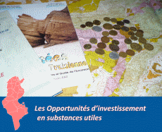
Investir en Tunisie |

|
|
|
|
|
::
Documentation and Editions
>>
Research library
|
| |
|
[
Search by author
]
[
Search keyword
]
[
Search by index
]
[
Search by category
]
|
title of the reference :
|
Analysis of bathymetry and submarine topography of the coast of east-central Tunisia with Landsat multispectral data.
|
|
Publication Date:
|
1982
|
|
Author :
|
Davis P.A.Jr, Grolier M.J., Eliason P.T., Schultejann P.A.
|
|
Catalogue type :
|
Livre
|
|
Catalogue reference :
|
Analysis of bathymetry and submarine topography of the coast of east-central Tunisia with Landsat multispectral data. analyse de la bathymétrie et de la topographie sous-marine de la côte centre-est de la Tunisie avec les données multispectrales Landsat. Internatl. Symp. Remote Sensing of Environment Proceedings of the Symp.
40 refer., bibliogr. bathymétrie ; LANDSAT ; télédétection multispectrale ; télédétection ; Tunisie ; Tunisie Centrale Grolier M.J. Eliason P.T. Schultejann P.A. Davis P.A.Jr Géologie Marine Environ Res. Inst. Mich.
|
|
Indexation decimale :
|
Géologie Marine
|
|
Keywords :
|
bathymétrie ; LANDSAT ; télédétection multispectrale ; télédétection ; Tunisie ; Tunisie Centrale
|
|
Summary :
|
|
|
Exemplaries :
|
-
|
|
|
|
|
|
|
|