|
The geochemical inventory that has been fulfilled so far in the NOM does cover the north (nap and dome zones), central and western Tunisia along with a part of the fluoride province. 78 breaks in 1/50000 are treated by this inventory along with 46 000 sample-taking “stream sediment” in a rate of 2 up to 3 sample/km2. They are analyzed in multi-elements between 14 and 23 chemical elements totalizing approximately 800000 geochemical indications.
The geological prospecting has been used in the NOM since 1979. It intervenes in the different stages of mining research for upstream in the strategic phase (scale 1/50 000), and for downstream in the tactic phase (scale 1/5 000).
Since 1997, the regional-geochemical-synthetic maps, which are numeric and on hard copy in 1/500000 and 1/200000, have been produced. Besides their important usefulness in the mining field, these maps are used for a practical purpose in the environment, agriculture, territory-development, and public-health domains. They allow the detection of polluted areas due to heavy-metal production, such as Plumb, Cadmium…etc, and are taking into consideration in choosing some hydraulic-work sites, such as barrages and lakes.
|

Status of the strategic geochemical inventory
(Larger image - click here)

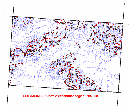
Example of decision-making-assistance documents issued from the synthesis of regional chemistry 1/500 000
(Larger image - click here)

The Salines: Sampling map in 1/500000
(Larger image - click here)
|


