|
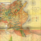
Tunisia has had a proven track tradition in the domain of geological cartography. Indeed, the first world map appeared in 1982. That was the provisional geological map of Tunisia in 1/800000 scale, which was drawn by Francis Aubert and accompanied by a ninety-one-page instructions.
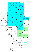
From 1924 to 1935, Marcel Soligance fulfilled 22-provisional geological maps in 1/200000 scale, which covered approximately the whole country.
Building on the 1/200000 scale-cover of the geologic data, Mr. Soligance achieved the first geologic map in 1/500000 scale. This map was made of three breaks (north, south, and extreme south). It was accompanied with a seventy-seven-page instruction.
The basic geological cartography started in 1945. Since that date, fulfilling the geological covering in 1/500000 for the north and the center and in 1/100000 for the south has been a national and strategic goal.
|

Geological map 1/800.000
Aubert (1892)
(Larger image - click here)

Preliminary geological cuts to 1 / 200 000
(Solignac, 1924-1935)
(Larger image - click here)
|


