| Annual program and technical progress report |
-

Technical Program 2025
-

Activity Report 2023
|
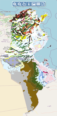
| Geocatalogue |

|
| Invitation to
tender |
-

REALIZATION OF THE TRAINING PLAN FOR THE YEAR 2022
-

ACQUISITION OF TWO SERVICE CARS
-

ACQUISITION OF GEORADAR EQUIPMENT AND ITS ACCESSORIES
|
|
Invest in Tunisia |

|
|
|
|
|
::
Documentation and Editions
>>
Research library
|
| |
|
[
Search by author
]
[
Search keyword
]
[
Search by index
]
[
Search by category
]
|
title of the reference :
|
Paleozoic-Mesozoic facies evolution and related hydrocarbon system of the Kebili Area (Central Tunisia).
|
|
Publication Date:
|
1998
|
|
Author :
|
Pogacsas G.Y., M'rabet Ali, Haas Georges, Samu L., Vakarcs C.
|
|
Catalogue type :
|
Livre
|
|
Catalogue reference :
|
Paleozoic-Mesozoic facies evolution and related hydrocarbon system of the Kebili Area (Central Tunisia). The Kebili area is situated in the southern part of Central Tunisia, at the margin of the Sahara Platform A ridge of NW-SE direction developped during the carboniferous on which denudation proceeded up to the Triassic. In the triassic, in addition to the volcanism, rifting commenced in the ridge's aera with terrestrial sedimentation. During the late Triassic trenches and ridges of E-W direction developed that led to the separation of the Chott basin. During the Middle and the Upper Jurassic, the subsidence of the Chotts basin became faster producing superthick peltic carbonate/evaporite marine sediments. Due to the progradation of fluviatile-delta system in the early Cretaceous, siliciclastic sedimentation has become predominating. In the Aptian, regional uplift proceeded that was followed by trans-regression cycle up to the end of the cretaceous. Subsequently to the Cretaceous (Paleogene) terrestrial erosion proceeded before Miocene. The Kebili area consists of four domains. The south domain belongs to the Saharian platform characterized by Hercynian and/or pre-hercynian normal faulting. The Hercynian fault pattern is slightly overprinted by late Mesozoic (Austrian) and tertiary tectonic reactivation. The orientation of the relativity short Palaeozoic faults are E-W, NE-SW and SE-NW. The Sahara platform domain is boundered by a wide fairly deformed right lateral transform fault zone. This wide right lateral transform zone domain is the southern, boundary of the Mesozoic trough System. The large E-W trending Limaguess anticline represents the third structural domain of the area. The Mesozoic sediments were inverted during the Austrian compression event. The fourth (northeast) structural domain coincided with the uninverted part of the Fedjedj Trough. It is characterized by NNE-SSW oriented normal faults and/or strike-slip faults. 2D finite-element Petro-Mod software package was used to reconstruct the thermal and maturity history. According to the model at present, the deeper parts of the Lower-Cretaceous, the Malm and the uplifted parts of Dogger and Lias units are in the early oil-mature oil window (Ro=0,9-1,2%). The deeper parts of Malm actually are in the mature oil-peak oil window (Ro=1,2-2,0%). The uplifted parts of the Ordovicien and Silurian are in the wet gas window and in the mature oil-peak oil window respectively. The possible Jurassic source reached the early oil window at about 120 million years before present in the deeper part of the basin (80-150 Km gridpoint), the Silurian is overmatured (Ro=2,0%) while pinch-out zone is in the peak oil-wet gas-condensate window. The Silurian reached the early oil window at about 160 milloion years before present. The Ordovician reached the early oil window (Ro=0,6%) at about 200 million years before present.
ETAP MEMOIR N°12
profil sismique ; fracturation ; Ordovicien ; Silurien ; Dévonien ; Carbonifère ; Jurassique ; carbone organique ; maturation ; paléogéographie ; réflectogramme ; Tunisie ; Tunisie Sud occidentale ; kebili ; Chott Jerid Samu L. Vakarcs C. M'rabet Ali Haas Georges Pogacsas G.Y. Géologie régionale - Cartes
|
|
Indexation decimale :
|
Géologie régionale - Cartes
|
|
Keywords :
|
profil sismique ; fracturation ; Ordovicien ; Silurien ; Dévonien ; Carbonifère ; Jurassique ; carbone organique ; maturation ; paléogéographie ; réflectogramme ; Tunisie ; Tunisie Sud occidentale ; kebili ; Chott Jerid
|
|
Summary :
|
The Kebili area is situated in the southern part of Central Tunisia, at the margin of the Sahara Platform A ridge of NW-SE direction developped during the carboniferous on which denudation proceeded up to the Triassic. In the triassic, in addition to the volcanism, rifting commenced in the ridge's aera with terrestrial sedimentation. During the late Triassic trenches and ridges of E-W direction developed that led to the separation of the Chott basin. During the Middle and the Upper Jurassic, the subsidence of the Chotts basin became faster producing superthick peltic carbonate/evaporite marine sediments. Due to the progradation of fluviatile-delta system in the early Cretaceous, siliciclastic sedimentation has become predominating. In the Aptian, regional uplift proceeded that was followed by trans-regression cycle up to the end of the cretaceous. Subsequently to the Cretaceous (Paleogene) terrestrial erosion proceeded before Miocene. The Kebili area consists of four domains. The south domain belongs to the Saharian platform characterized by Hercynian and/or pre-hercynian normal faulting. The Hercynian fault pattern is slightly overprinted by late Mesozoic (Austrian) and tertiary tectonic reactivation. The orientation of the relativity short Palaeozoic faults are E-W, NE-SW and SE-NW. The Sahara platform domain is boundered by a wide fairly deformed right lateral transform fault zone. This wide right lateral transform zone domain is the southern, boundary of the Mesozoic trough System. The large E-W trending Limaguess anticline represents the third structural domain of the area. The Mesozoic sediments were inverted during the Austrian compression event. The fourth (northeast) structural domain coincided with the uninverted part of the Fedjedj Trough. It is characterized by NNE-SSW oriented normal faults and/or strike-slip faults. 2D finite-element Petro-Mod software package was used to reconstruct the thermal and maturity history. According to the model at present, the deeper parts of the Lower-Cretaceous, the Malm and the uplifted parts of Dogger and Lias units are in the early oil-mature oil window (Ro=0,9-1,2%). The deeper parts of Malm actually are in the mature oil-peak oil window (Ro=1,2-2,0%). The uplifted parts of the Ordovicien and Silurian are in the wet gas window and in the mature oil-peak oil window respectively. The possible Jurassic source reached the early oil window at about 120 million years before present in the deeper part of the basin (80-150 Km gridpoint), the Silurian is overmatured (Ro=2,0%) while pinch-out zone is in the peak oil-wet gas-condensate window. The Silurian reached the early oil window at about 160 milloion years before present. The Ordovician reached the early oil window (Ro=0,6%) at about 200 million years before present.
|
|
Exemplaries :
|
-
|
|
|
|
|
|
|
|


